
Until recently, if you’d asked me to tell you my all-time favorite hike, the answer was easy: the Highline Trail from Logan Pass in Montana’s Glacier National Park. But after hiking in Sunshine Meadows last week, I just may have a new favorite. If not, it’s at least a tie. Both hikes have the kind of dramatic beauty that takes your breath away every time you come around a curve in the trail to a different view.
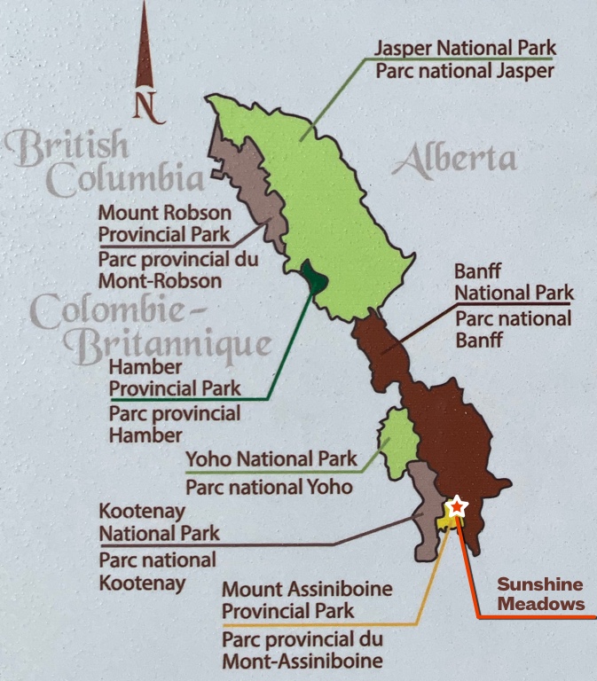
Sunshine Meadows straddles the Continental Divide, high in the Canadian Rockies on the border between the provinces of British Columbia and Alberta, about an hour west of Calgary. Most of the area lies within B.C.’s Mount Assiniboine Provincial Park, but a portion of it is in Alberta’s Banff National Park. Both parks are part of the huge UNESCO Canadian Rocky Mountain Parks World Heritage Site.
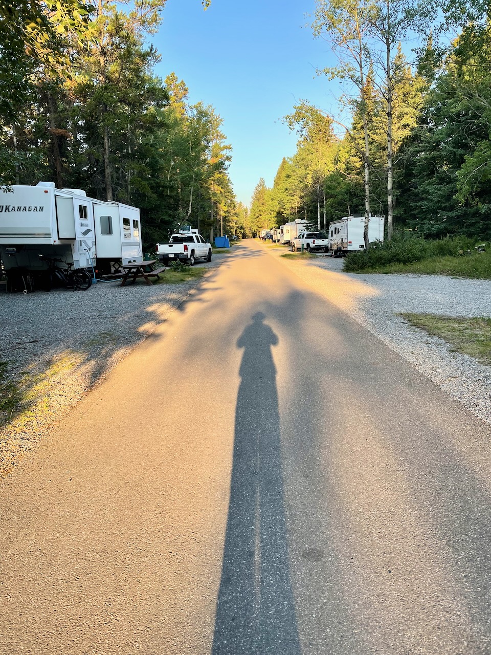
My journey to Sunshine Meadows began with an early morning departure from our Tunnel Mountain Campground RV site to catch the Roam Transit bus into downtown Banff. The sun was still low in the sky and the shadows were long.
From Banff, I caught the free Sunshine Shuttle for the ride out to the Sunshine ski resort, about 25 minutes away. The shuttle runs once every hour or so throughout the day. The shuttle dropped me off near the lower Sunshine Gondola terminal.
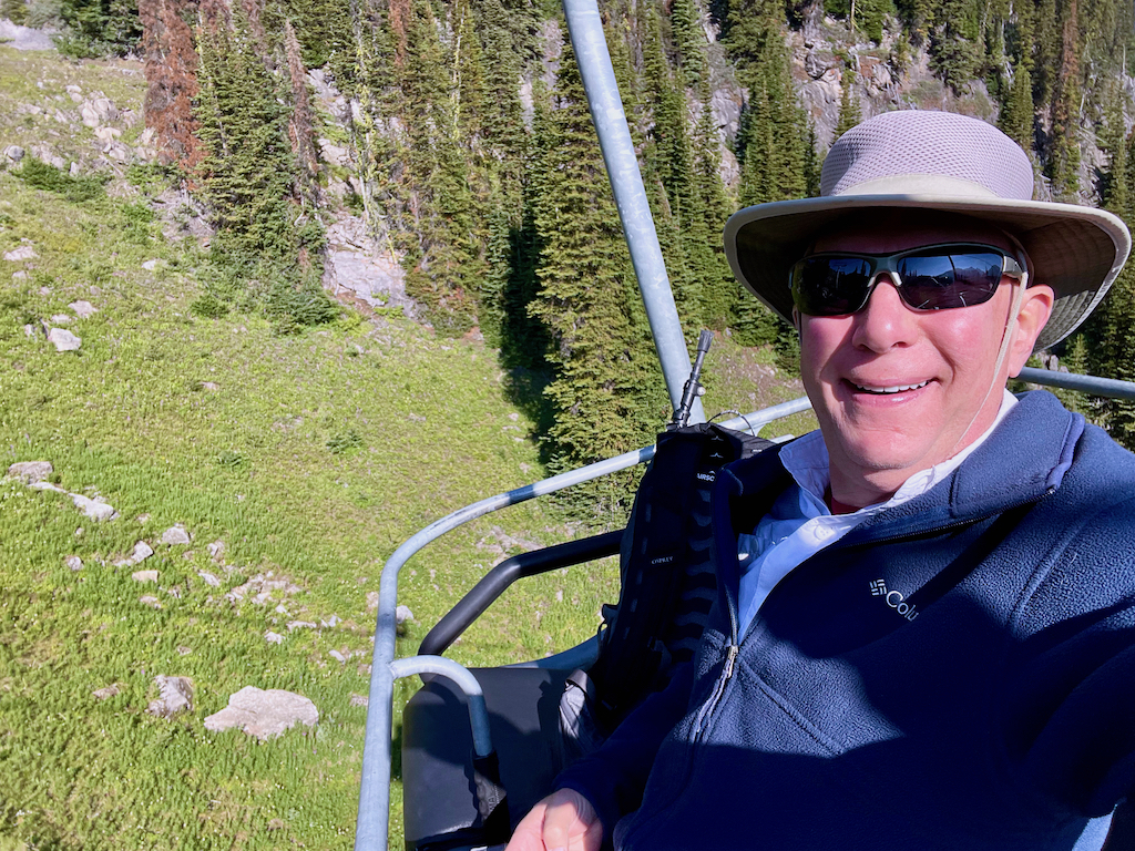
Here, I purchased a ticket for the gondola and the chair lift that would take me to the summit of Mount Standish. The adult ticket price is CA$65.00 + tax, which seemed pretty steep until I realized the gondola ride is 17 minutes long and covers three long segments of cable around and then up the mountain. From the upper gondola terminal, I boarded the Standish Chairlift to get to the summit of the mountain and the start of my hike.
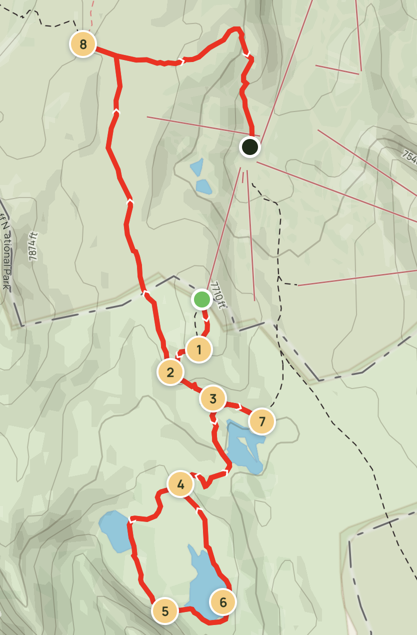 The route I had selected took me from the top of the Standish Chairlift (the green dot), right on the Continental Divide and the Alberta-British Columbia border, to the Standish Viewpoint (#1 on the map), then down from the summit to the junction with the Twin Cairns Trail (#2).
From there, I planned to head to the junction with the Rock Isle Trail (#3), turn right to go around the Grizzly/Larix Lake Loop (#4), pass by Grizzly Lake, and stop at the Standish Viewpoint (#5) and at Larix Lake (#6) before retracing my steps back to the Rock Isle junction. There, I would turn right to go to the Rock Isle Viewpoint (#7), where I would eat the lunch I’d brought with me.
After lunch, I’d walk back uphill to the Rock Isle Trail junction, but this time I planned to continue straight to join the Twin Cairns-Meadow Park Trail. This trail traverses Sunshine Meadows proper, the largest alpine meadows in the Canadian Rockies. This trail would take me below Twin Cairns Ridge and northwards with great views of the mountains all around. At the T-junction at the end of the trail, I planned to turn left to the Monarch Viewpoint before turning around and heading back to upper Sunshine Village (the green and black dot) for the gondola ride back down the mountain.
Shortly after I stepped off the chairlift and onto the summit of Mount Standish, I realized that this hike was going to consist of one breathtaking “oh my gosh” moment after another–and that attempting to choose just a few photo highlights for a blog post just wasn’t going to cut it. So instead, I compiled more than 100 photos into this six-and-a-half-minute video that will–I hope–give you at least a taste of the awe-inspiring beauty I experienced.
Sunshine Meadows is a very popular hike. You’ll see many other hikers on the trail from countries all over the world, including quite a few Sunshine Village employees on the sections of the trail from the Standish Viewpoint to the Grizzly/Larix Lake Loop. Even so, it’s a good idea to be “bear-aware” and to carry and know how to use bear spray during berry season in July and August. If you’re new to bear country, an employee will give you an orientation and tips as you leave the upper gondola terminal. And of course, pack out anything you bring with you–there are no trash cans along the trail. (There are, however, pit toilet-style outhouses near Grizzly Lake and the Rock Isle Viewpoing.)
As far as I’m concerned, the Sunshine Meadows hike should be on everyone’s “must-do” list for a summertime visit to Banff. The full route as I hiked it was just slightly more than seven miles long with about 1,130 total feet of elevation gain. All of that gain is on relatively gentle grades, and most of it is confined to the section of the trail from Grizzly and Larix Lakes back to the main trail, and from Rock Isle Viewpoint back to Twin Cairns Junction. If you’d prefer a shorter hike–and one that is almost entirely level or downhill!–just continue on the trail past Rock Isle Viewpoint northwards to return to the upper gondola terminal, skipping the section of the trail that goes through the meadow past Mount Standish to the Monarch Viewpoint. This will make your hike a bit less than four miles long with minimal total elevation gain.
This is a hike to remember, and one that almost anyone can do!
Discover more from LANDMARK ADVENTURES
Subscribe to get the latest posts sent to your email.
what a beautiful place to visit!1